
About the event
The 12 km route with 869 meters in altitude showcases Bontoc's the road to mountains character of the town. The event has Junior (U20) and Senior categories where the top 3 male and female shall battle for the gold, silver and bronze awards. A country team champion award will be recognized (time of 2 male and 1 female).
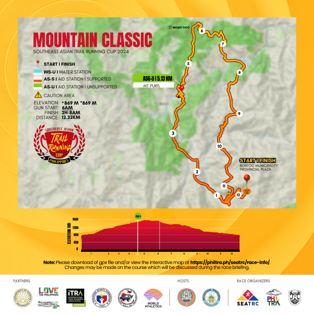
Course Map
- Start Time: 6AM, Sunday, June 23, 2024
- Cut-off Time: Finish Line - 8am, June 23, 2024
- Awarding: 3pm, June 23, 2024
- COURSE: Trace de Trail : SEATRC-TAWID MOUNTAIN CLASSIC
Course Profile
From the Plaza, the runners will ascend to Mount Fato - a beginner tourist trail known for offering the best view of the sunset. The ascent will cover about 613 meters gain over 3.77 kilometers, leading to the aid station (AS5) at Mount Pukis. They shall continue for another 2k of climbing until they reach Mount Fato Viewing Point with another 200 meter gain. The trails will be a mix of single track trail and fire roads amidst the pine forest. Runners of the 12k race upon reaching Mount Fato will turn towards the trails heading to the finish line. The descent will be a technical single track trail and runners are advised to descend with caution. The runners shall exit to a wide dirt road and will continue their descent towards the finish line.
AS5 (Mt Pukis)
- Coordinates: 17.10540532, 120.96601513
- Distance from Start: 3.78 km
- Distance from Previous Section: 3.78 km
- Cumulative Elevation Gain: 613 m
- Cumulative Elevation Loss: 28 m
Finish Line
- Coordinates: 17.09051134, 120.97695216
- Distance from Start: 12.3 km
- Distance from Previous Section: 9.1 km
- Cumulative Elevation Gain: 877 m
- Cumulative Elevation Loss: 866 m